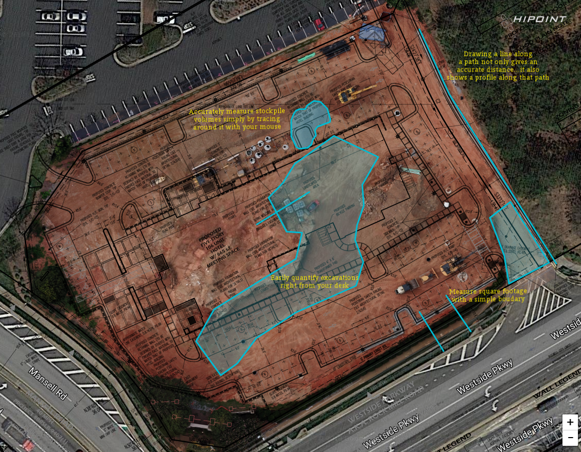
In the office, Hi Point Mapping will create a pre-programmed, repeatable, flight mission for your project. On your schedule, be it weekly, bi-weekly, or monthly, we will fly your project site and create an interactive map that will delivered directly to your inbox.
With this map, not only will you see the progress that is being made at the site, you will also be able to take accurate measurements such as volumes of excavation and stockpiles, linear measurements of materials like curb and gutter, and the square footage of paved areas without having to leave your office!